Riverwalk in Lane’s Backyard
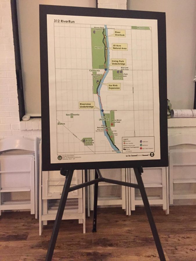
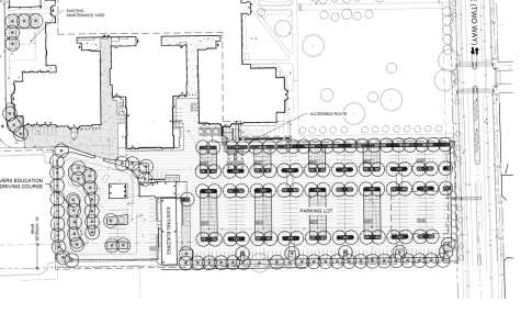
A map of the 312 Riverwalk
April 11, 2018
Two of the Chicago River’s 156 miles have been hidden behind old fences and bushes for years on the Northwest side of Chicago.
But that will soon change. According to Keith O’Herin, the president of the California Park Advisory Council (CPAC), the most important part of his organization’s renovation project is to be able to view and access the entire length of the river from California Park. The area that is being focused on extends from Montrose and California, behind Horner Park to Addison and California, behind DePaul College Prep.
A public event was held at Trigger, a local banquet hall right in Lane’s backyard on Addison and California. This event was held by CPAC to discuss the new projects that are occurring in the area.
This board consists of various members who helped put this plan into action. The Lakefront Planning Coordinator Sarah White primarily explained all of the blueprints that have been created of the 312 Riverwalk on Feb. 21.
California Park is located on 3843 N. California Ave. in Chicago, IL right next to DePaul College Prep and just over the bridge from Lane on Addison St. The riverwalk is a path that will run along the north end of the Chicago River. It will be built on the edge of the bank that currently exists and run approximately two miles from the north end to the south end.
“Connecting our open spaces is a really big priority, so being able to partner with CPAC was kind of a no-brainer for us,” White said.
The alderman of the 33rd ward, Deb Mell, also contributed to this new riverwalk project.
“I think a lot of people would use it for leisure, but they could also use it for commuting, it would reduce traffic,” Mell said. “Our river is an untapped resource that we really need to start enjoying, so I was really excited when the park district started getting involved and working on it.”
Although he is new to the Irving Park/ North Center neighborhood, he heard about the project from a previous article he had read.
“We kind of knew it was coming because we had heard rumors about it,” O’Herin said. “But we wanted to be organized so then when it did actually come we would be much better organized to better deal with it and represent the park.”
This is when O’Herin decided that he wanted to get more involved.
White explained how CPAC wants a space for people in the neighborhood to be able to enjoy and get good use out of.
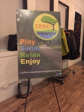
The California Park Advisory Council Logo
“This planning has gone back years,” O’Herin said. “I think 2012 is when they started.”
During the meeting, White explained how the river walk’s northern point will start at Horner Park on the Montrose Ave. side, and end at its southern point which would be Clark Park. The pathway would stretch a total of two miles. This would allow easier access for the general public and for sports teams such as rowing that use the river for practice and competitions.
This new trail will be beneficial to the community as a whole in more ways than simply for leisure.
“It would be great to have more traffic of people going in and out [of the park]. It would create a more vibrant community than what we already have,” Mell said.
White said that this would allow for most inner city people having the experience of being able to have a nice trail nearby to use and not have to drive to the suburbs. This may possibly even encourage more people to move into the area to use it.
CPAC estimates that the riverwalk project will be completed by the end of the summer of 2019. New features of the riverwalk include replanting of the bank so that it is not so steep, along with lighting for the night time. California Park will also have direct access to the riverwalk from the South East corner of the Tennis courts, White said.